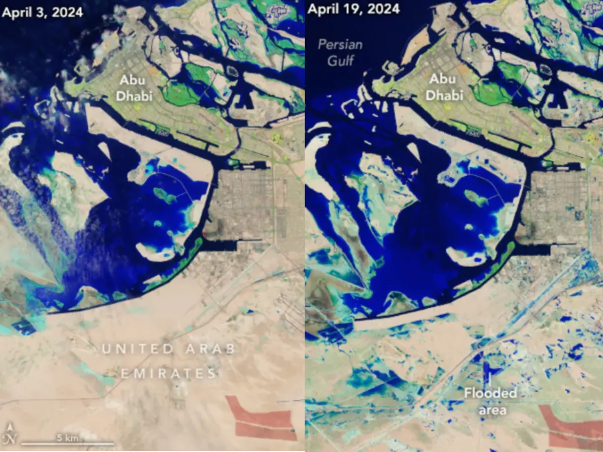
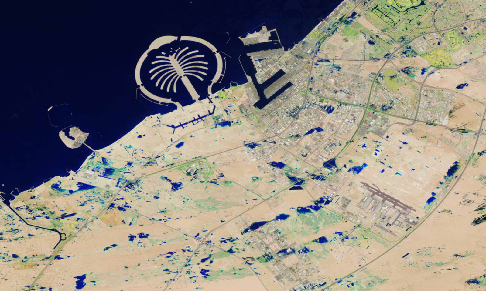
NASA published images of sections of Dubai and Abu Dhabi taken both before and after the country’s record-breaking rains last week, which left most of the country in a state of paralysis and resulted in hazardous flooding.
About NASA publishes satellite images of Flood
In less than a day, about a year’s worth of rain fell on the usually arid desert nation.
The flood ruined automobiles, businesses, and other property in addition to closing schools and businesses and forcing hundreds of aircraft to be grounded.
Many locals lost access to running water and electricity, while others were stuck inside their houses, at airports, or wherever they happened to be when the storm made landfall. It completely disrupted daily life.
Large areas of water can be seen throughout the UAE’s desert and urban terrain where there were previously none, nearly giving the impression that little lakes had arisen. The photos were captured on Friday by the NASA Earth Observatory using Landsat data from the U.S. Geological Survey.
When Landsat 9 flew over the area on April 19, it was the first time since the storms, and some regions were still flooded, according to a NASA statement on the Earth Observatory website.
Hundreds of drivers were forced to ditch their automobiles on roadways in order to escape the increasing water levels after flash floods on April 16 caused water to swallow them and, in some instances, completely submerge them.
In less than a day, the usually arid Gulf desert nation experienced more rain in one storm than it has ever seen since records for the United Arab Emirates were kept in 1949—roughly a year’s worth.
The flood ruined automobiles, businesses, and other property in addition to closing schools and businesses and forcing hundreds of aircraft to be grounded. Many locals lost access to running water and electricity, while others were stuck inside their houses, at airports, or wherever they happened to be when the storm made landfall. It completely disrupted daily life.
According to the UAE’s National Center of Meteorology, rain in the country’s east might reach 250 millimeters, or 10 inches, in less than a day. In comparison, the United Arab Emirates normally receives 5.5 to 8 inches of precipitation annually.
Much of the water had nowhere to go because the nation’s urban regions are paved over and there is a lack of drainage infrastructure, which made the flooding in many locations worse.
Even while the nation is working to clean up after the disaster, many areas still have a lot of issues and many inhabitants report not having access to electricity or running water.
Due to storm-related structural damage, a multistory residential building close to the border between Sharjah and Dubai has tipped over and fractured. It was completely evacuated on Friday because it could collapse.
To aid individuals and businesses affected by flooding, the central bank of the United Arab Emirates (UAE) has instructed local banks and insurance providers to grant six-month loan repayment deferrals.